|
| Day 7 Route (unpaved section highlighted in red) |
 |
| Kattarhyggur Bridge (Cat´s Arch) |
The distance between our hotels on Day 7 was just 212 kilometres or 2.5 hours away, so we decided to explore the Snæfellsnes Peninsula that afternoon. I decided to trust my memory instead of writing down the intended route. That was to be my comeuppance; I made the mistake of saying to turn onto Route 55 (to get to Route 54) instead of Route 56. Route 55 was a gravel road, albeit in very good condition. At that time, I assumed that Route 54 was all paved, so it would not be a problem. Oops, it turned out that ~ 75 km of Route 54 was unpaved and we had to drive 40 kms on a rough section before returning to paved road. Two hours on gravel roads was unanticipated and unscheduled. All I have to say for myself is that it wasn't a gravel switch-back going up a mountain through the fog without guard rails. (https://sandrawhiteway.blogspot.com/2022/12/iceland-day-4-dramatic-skies-waterfalls.html).
Our first stop since leaving Skagafjörður was at the Kattahryggur bridge, commonly known as the Cat´s Arch. It was one of the first concrete bridges built in Iceland along the old Akureyri Road. This road was originally used for horse-drawn carriages and later motorized vehicles. The subsequent stops had beautiful views of the Baula and Litla-Baula Mountains; which are laccoliths, a type of intrusive rock with a domed top surface and a level base. These mountains are 3.4 million years old.
 |
| Baula and Litla-Baula Mountains from Glanni Waterfall Trail. |
Coming from a place where storytelling or "spinning a yarn" is so deeply woven into our cultural fabric tends to make people appreciate the stories of other cultures. I think Iceland could take the storytelling crown. Every location in Iceland, whether it's a waterfall, a mountain or a settlement, seems to have a story associated with it that somehow incorporates gods, elves, trolls and other mythical creatures. Our next stop was to visit Glanni Waterfall on the Nordura River. Rumor has it that Glanni is home to elves and trolls, but you are more likely to encounter salmon since the Nordura River is known for great salmon fishing.
 |
| Glanni Waterfalls on the Nordura River |
Next up was our adventure around the Snæfellsnes Peninsula. The first stop was a quick view of Eldborg Crater (translated means Fortress of Fire or Fire City). This crater presents a regular oval shape with a diameter of 200 metres and a depth of 50 metres. The surrounding lava fields were created by eruptions 5,000 to 8,000 years ago. Eldborg Crater is a 5 kilometres (3 miles) round trip hike from Snorrastaðir farm.
 |
| Eldborg Crater (Fortress of Fire) |
A couple of minutes past our stop at Eldborg Crater, we began our alternative route to the north shore of the Snæfellsnes Peninsula. We transversed the peninsula via gravel roads (Route 55 and part of Route 54). The views were lovely but realistically stopping and taking Route 56 immediately would have been the sensible decision due to time constraints. In addition, the rental vehicle was small, a Kia Ceed. We saw a lovely church in a field by itself. Google maps identified it as Breiðabólsstaðarkirkja, either there are two churches with the same name or this one is called something else. Approximately 8 kilometres further we stopped to photograph a boat wreck across the water on an island.
 |
| Breiðabólsstaðarkirkja (maybe but google maps says it is) |
 |
| Boat Wreck on an Island |
It was along the unpaved section of Route 54 that we stopped to photograph one of the many stone cairns that we had seen. These stone cairns are ancient route markers made from lava rocks. In Iceland, these cairns (steinvarða) were traditionally placed along single-track roads to mark trails and date back to the 9th and 10th centuries. Tourism necessitated Icelandic Authorities to institute rules and rule 4 was “never dislodge stones or build cairns”. This article explains the reason and necessity for rule 4. (https://icelandmonitor.mbl.is/news/nature_and_travel/2019/07/05/tourists_warts_removed_by_park_rangers/)
 |
| Stone Cairns (Steinvarða) |
Eureka we hit pavement again as Route 56 joined Route 54. One of our stops was Kirkjufell (also known as Arrowhead Mountain in Game of Thrones) and when we arrived it was crowded. We avoided the crowds the best we could, got the photograph and continued on our way. Kirkjufell is very picturesque and while we would have also liked to have included Kirkjufellsfoss waterfall in a photo, crowds made that impossible. Like many beautiful spots in Iceland, I suspect the optimum times to photograph them would be sunrise and sunset and not just for the ideal light conditions.
 |
| Arrowhead Mountain in Game of Thrones (AKA Kirkjufell) |
Our next major stop was Hellissandur, a fishing village dating back to the 16th century located on the north-western point of the Snæfellsnes Peninsula. Our reason for stopping here was decidedly modern; street art. Street art transformed Hellissandur's closed and abandoned buildings due to the fishery downturn into beautiful and colourful works of art. A few pieces are showcased below. (https://vimeo.com/311365999).
 |
| Arctic Tern on Bird House by Ban Pesk 2019 |
 |
| Fears Conversation by Ban Pesk 2018 |
 |
| Terrors of Fróðá by Natalia Moguel, 2018 |
 |
| Bardur Protector of the Snaefellsnes by Camilo Arias, 2018 |
 |
| Crazy Birds by Ban Pesk , 2018 |
 |
| Bárðar Saga (Half Human Half Troll) by Nikki 10, 2018 |
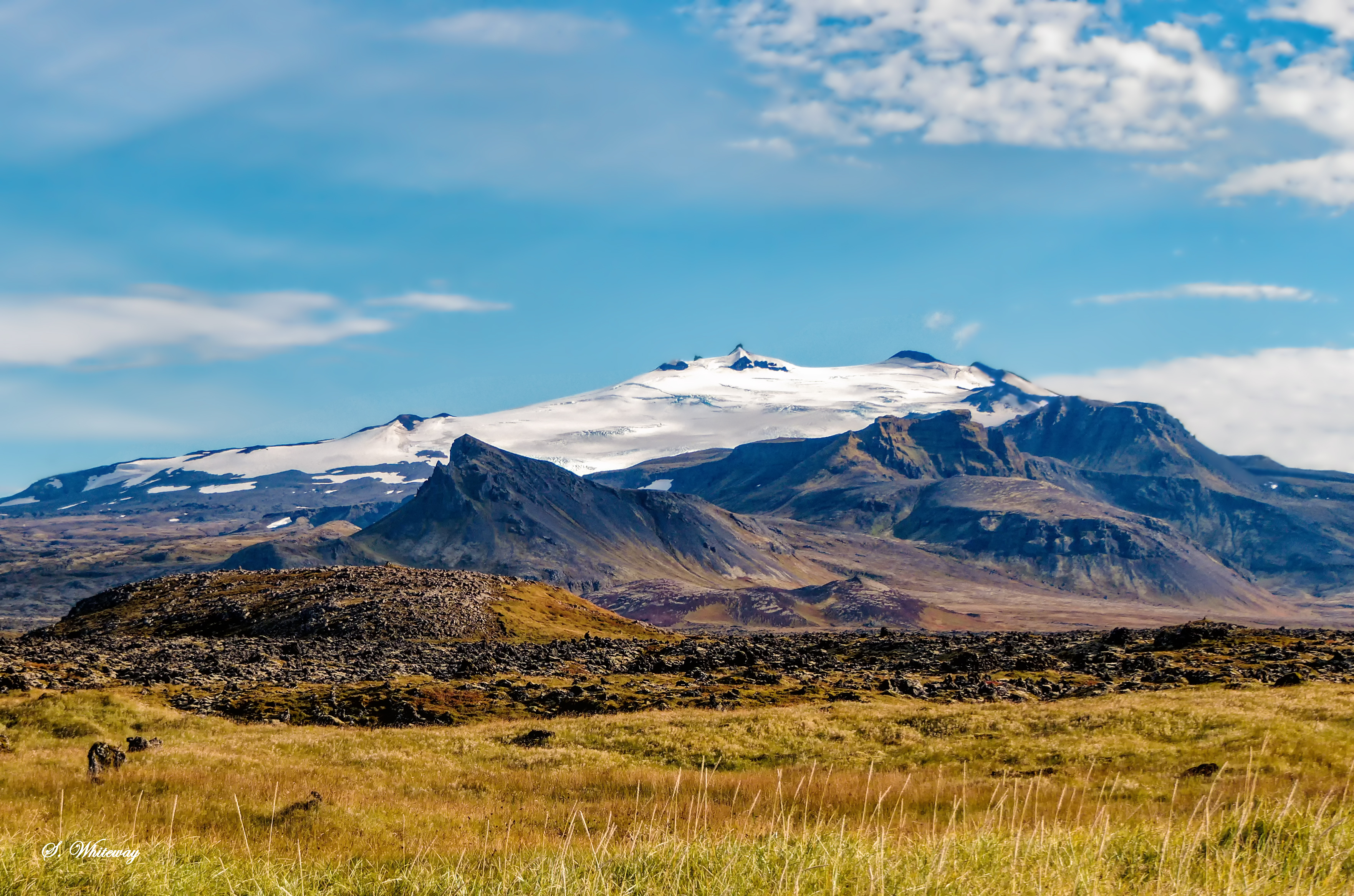
This was the point where our side trip along Route 56 caught up and the time crunch had arrived. We headed to our hotel outside of Borgarnes to prepare for our last day in Iceland. A few quick photo stops was all that time allowed.
 |
| View of Snæfellsjökull |
Video Clip


